Swallowtail Falls in Hogsback
← Explore Hogsback

Waterfall · Stream-side walk · Valley view

Swallowtail
Falls

An easy walk beside the stream to a cold natural pool, the top of the falls and a broad view over the Tyume Valley.

Known forWaterfall top and valley view
AccessWolfridge Road
DifficultyEasy walk
ViewpointFrom the top
Natural poolBoiling Pot
PermitNot required

The recommended visit

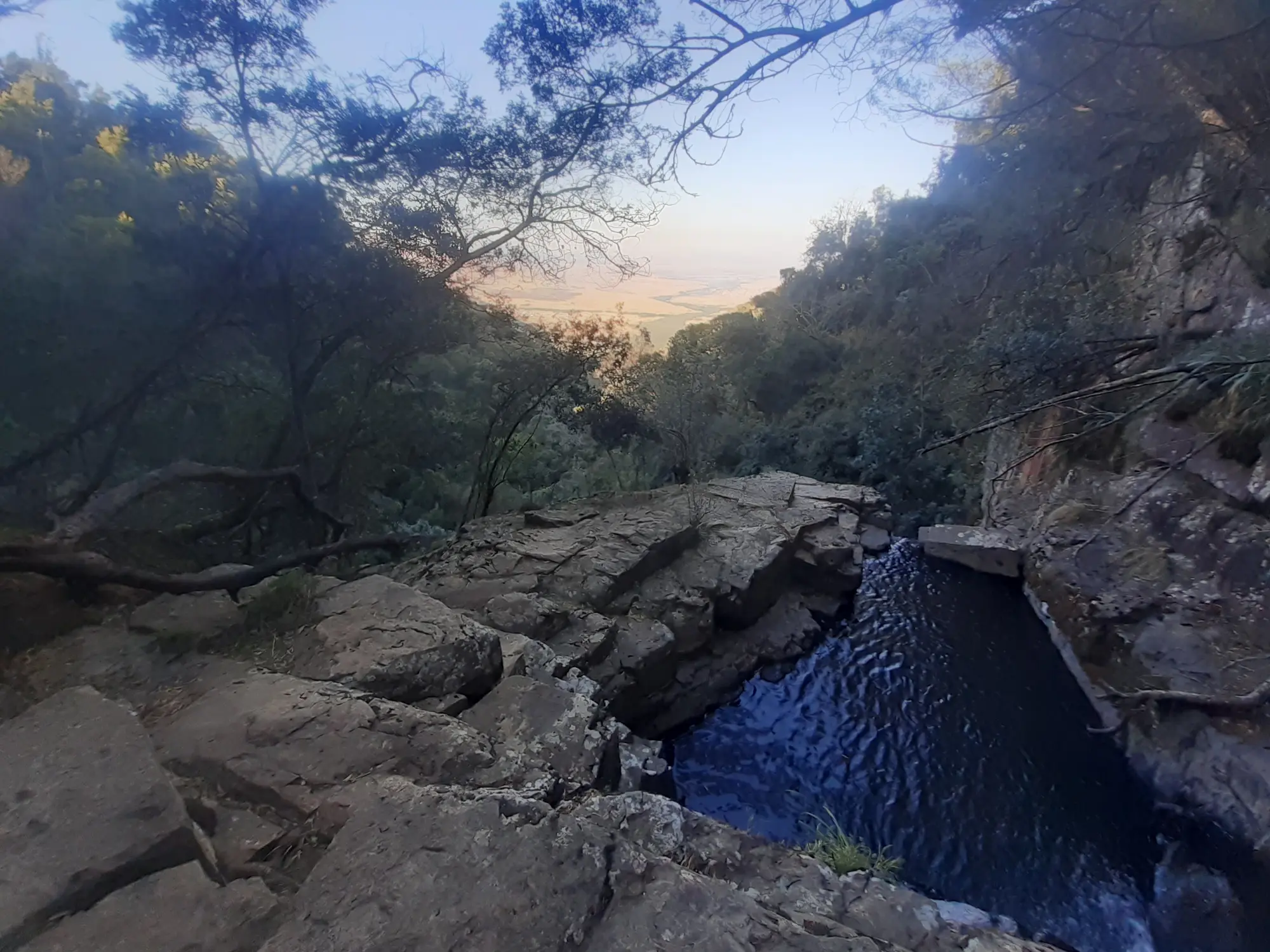
A waterfall experienced from above.

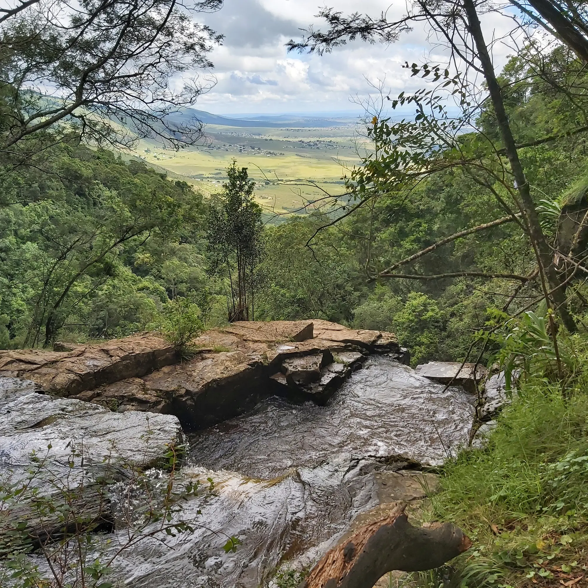
Swallowtail is different from Hogsback’s bottom-up waterfall views. The recommended route follows the stream through Hunterstoun to the pool and waterfall lip at the edge of the escarpment.

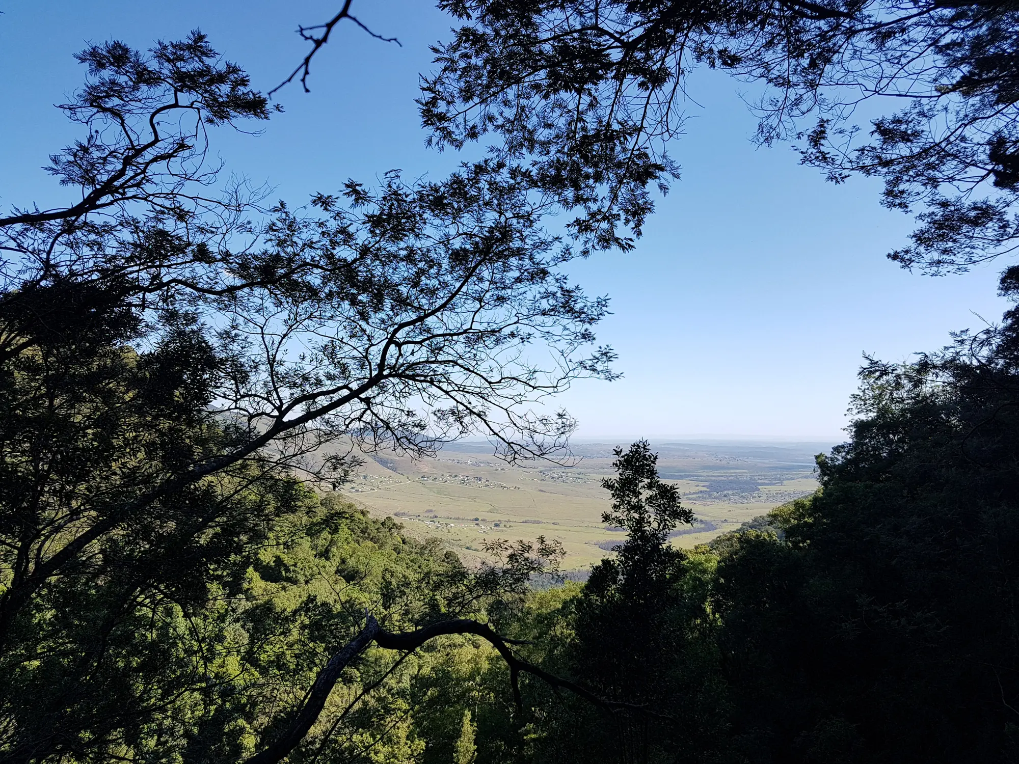
The stream, shaded walk and Tyume Valley panorama are as important as the falling water. Most visitors do not need to attempt the substantially harder route to the lower falls.

Top viewstream, natural pool
and Tyume Valley
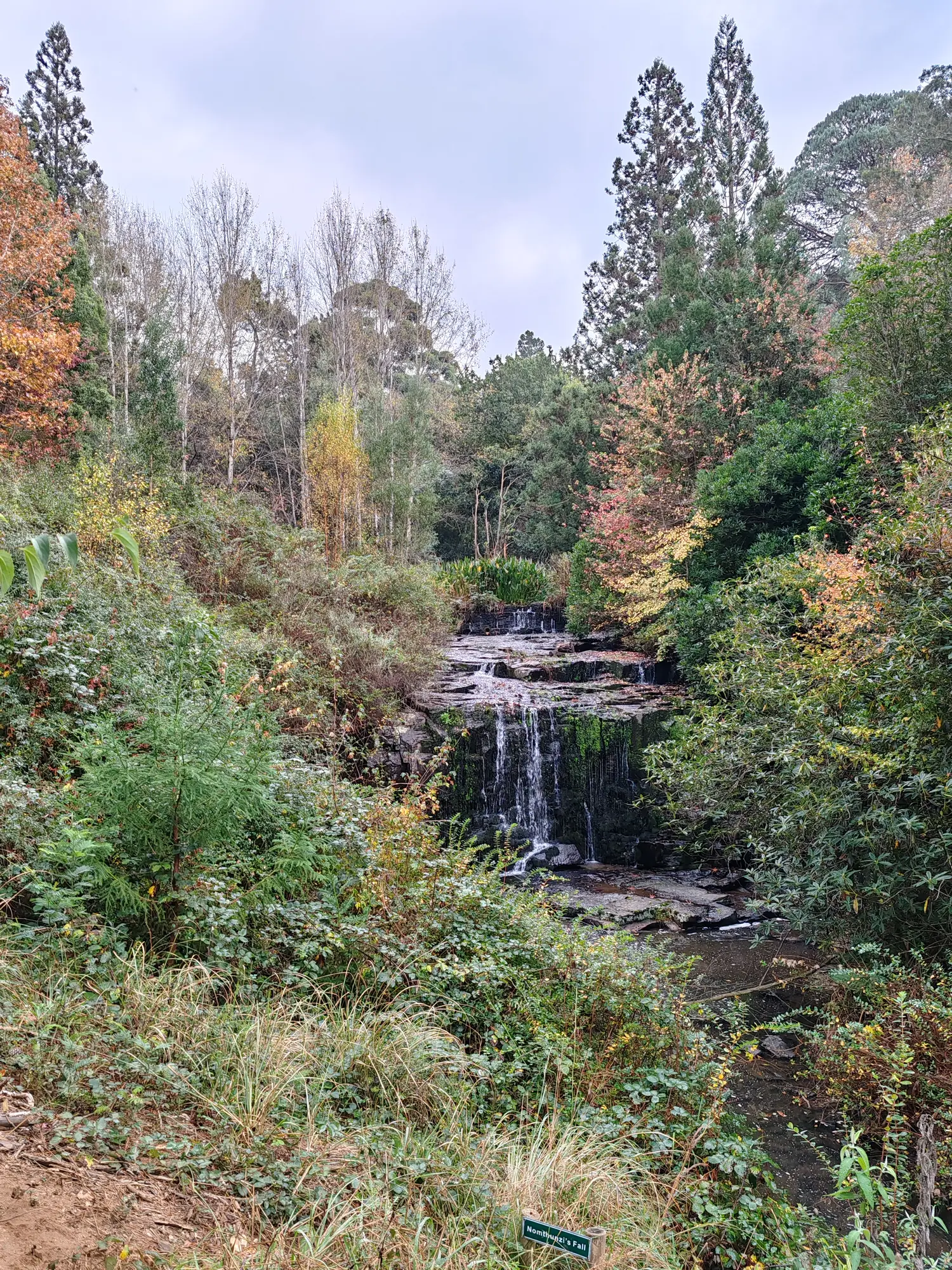
Swallowtail Falls and surrounding mountain landscape
Swallowtail changes with the season and recent rainfall.

The waterfall

Where the stream leaves the plateau.

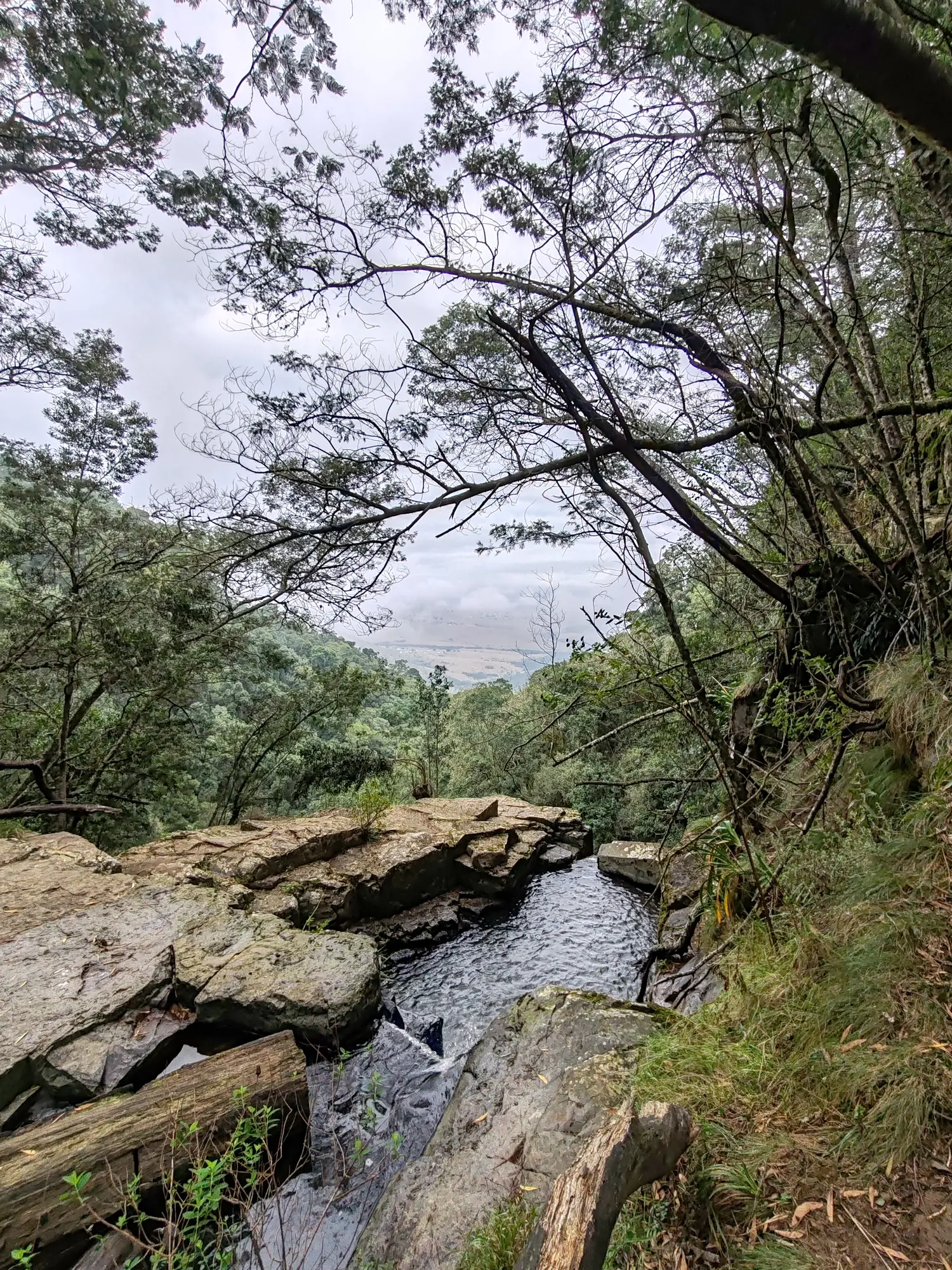
Swallowtail forms where the stream reaches the edge of the Hogsback escarpment and drops towards the Tyume Valley. The recommended path brings visitors to the upper watercourse, waterfall lip and valley viewpoint rather than a complete bottom-up view of the falling water.

Its character changes with rainfall. Wet periods bring stronger flow and a fuller pool, while drier weather exposes more rock. The broad valley view remains part of the destination even when the waterfall is carrying less water.

Swallowtail Falls and its surrounding landscape
The waterfall, stream and escarpment form one connected landscape.
The Swallowtail Falls walking routeNatural landscape beside Swallowtail Falls

The walk

Follow the water towards the valley.

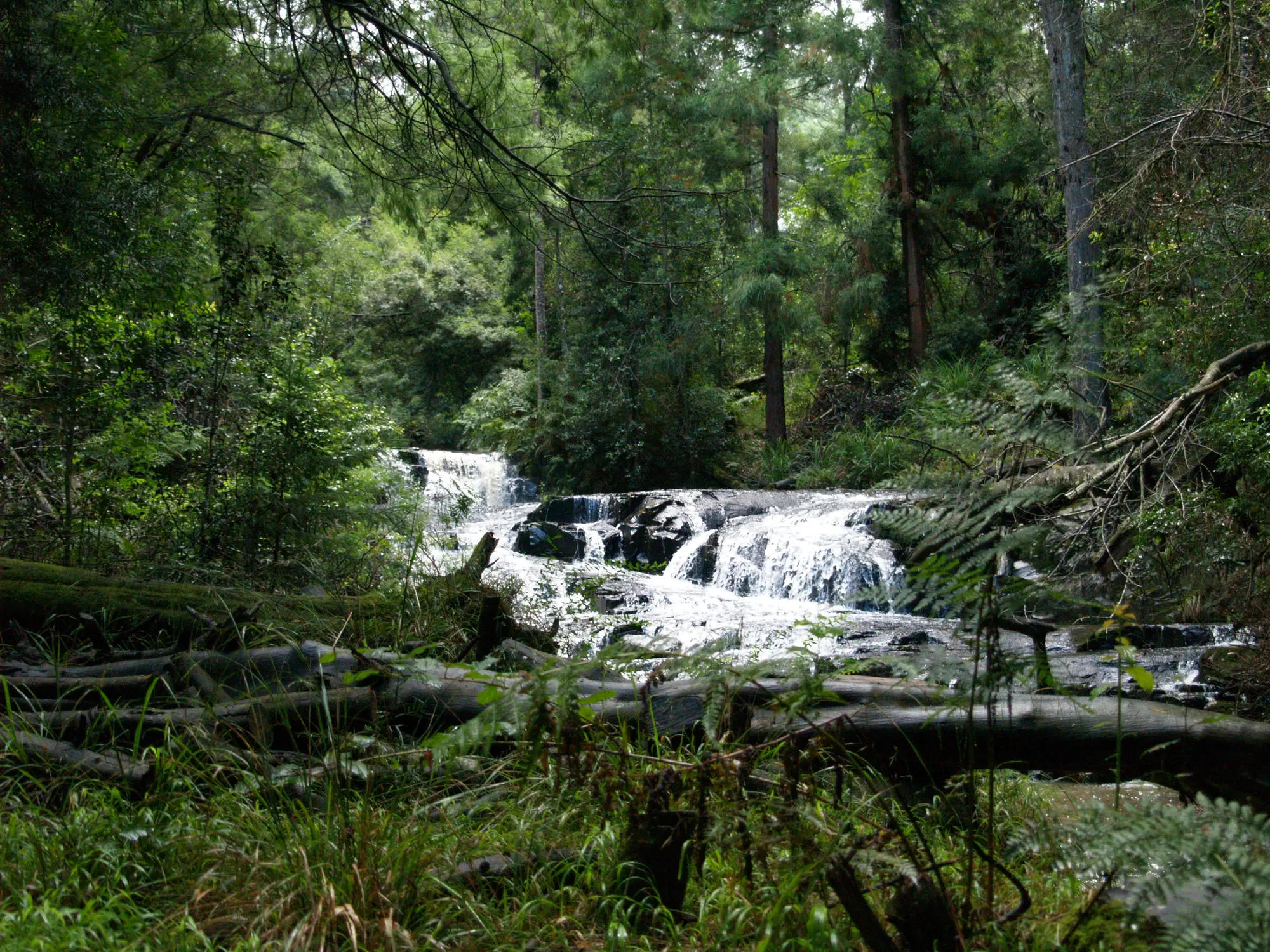
Much of the Wolfridge approach stays close to the stream. Expect shade, small crossings, rocks, damp vegetation and ground that may become muddy or boggy after rain.

The walk itself is approachable. The destination is not risk-free: the stream reaches a serious exposed cliff, and visitors should enjoy the view from safely back from the edge.

Hunterstoun

Public walking access through private land.

Swallowtail’s recognised route crosses Hunterstoun, a historic private Hogsback property established in the early twentieth century. The walking paths are shared with the public, but the land is not a public park.

  • Remain on recognised paths
  • Close gates where required
  • Keep dogs controlled
  • Avoid homes, gardens and private areas
  • Leave no litter and respect signs

Continued access depends on visitors treating the property as guests.

The natural pool

Boiling Pot: summer relief in mountain water.

Near the top, the stream widens into a natural pool known as Boiling Pot before continuing towards the waterfall. During peak summer heat the water can become pleasant for swimming and cooling off. In winter it remains decidedly cold. It is still a natural mountain pool rather than a managed swimming facility.

Flow, depth and slippery surfaces change with rainfall. Keep well away from the downstream edge, supervise children closely and avoid entering during unusually strong flow.

Walking routes

Two approaches. Two optional continuations.

The easy top route is the recommended Swallowtail visit. The forest approach reaches the lower waterfall and connects with the wider waterfall network.

All route geometry and distances are approximate. The top route uses the recorded Swallowtail route; additional routes reuse the established Madonna & Child map network.

Plan your visit

Practical information

The recognised route is easy and permit-free, but private-property etiquette, cold water and the exposed cliff require attention.

Where does the walk begin?+

The recommended access is from Wolfridge Road, near the quarry area, through the recognised Hunterstoun entrance.

Is Hunterstoun private property?+

Yes. Hunterstoun is privately owned, while the established Swallowtail walking paths are open to the public. Stay on the route and respect gates, homes, gardens and signs.

How difficult is the walk?+

The recommended route to the top is generally easy, with natural paths, damp ground, rocks and small water crossings. The lower forest approach is much harder and is not the standard visitor route.

Can I swim?+

The natural pool near the top is known as Boiling Pot. During peak summer heat it can be pleasant for swimming and cooling off; in winter the water remains cold. There are no lifeguards, and depth, flow and slippery surfaces vary.

Can children do the walk?+

Many children can manage the walk, but they need continuous close supervision at the pool and waterfall viewpoint because of the exposed cliff.

Are dogs permitted?+

Yes, on the recognised route. Keep dogs controlled around other walkers, private property, water and especially the cliff edge.

Do I need a permit?+

No permit is required for the recognised Swallowtail route. This does not allow access to unrelated private or restricted roads.

What happens after rain or in mist?+

Expect mud, boggy ground, stronger flow and slippery rock after rain. Mist can hide the valley and make the cliff edge harder to judge, so remain further back when visibility is poor.

Keep exploring

More waterfalls and hikes in Hogsback

Compare Swallowtail’s easy top approach with garden walks and longer indigenous-forest routes.

Waterfall

Guide in progress

Bridal Veil Falls

A rougher waterfall approach through the wider forest network.

Guide coming soon
Waterfall

Guide in progress

Kettlespout Falls

A distinctive waterfall walk with a different landscape and approach.

Guide coming soon