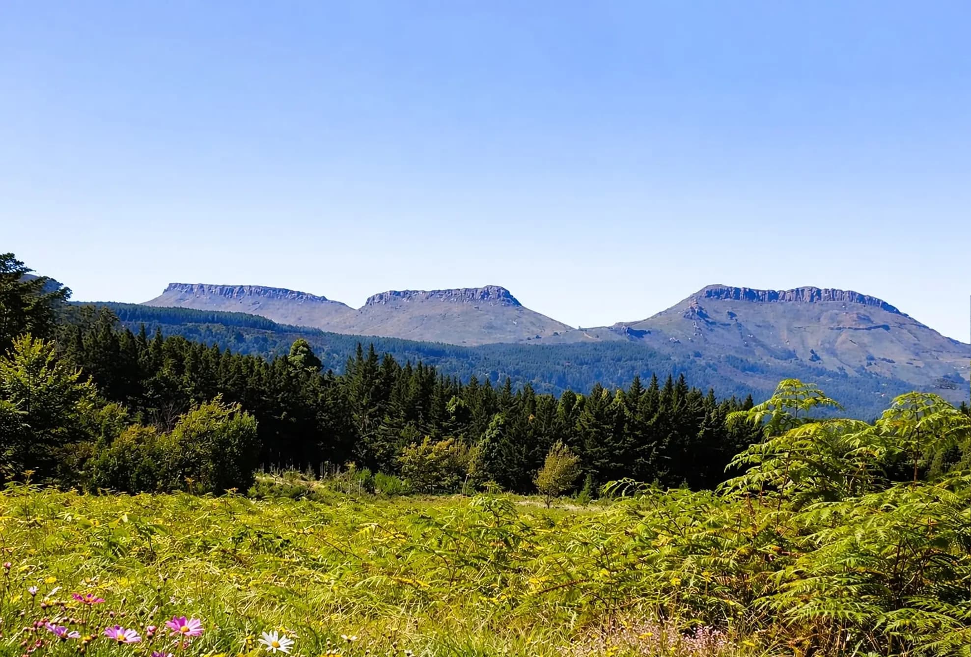
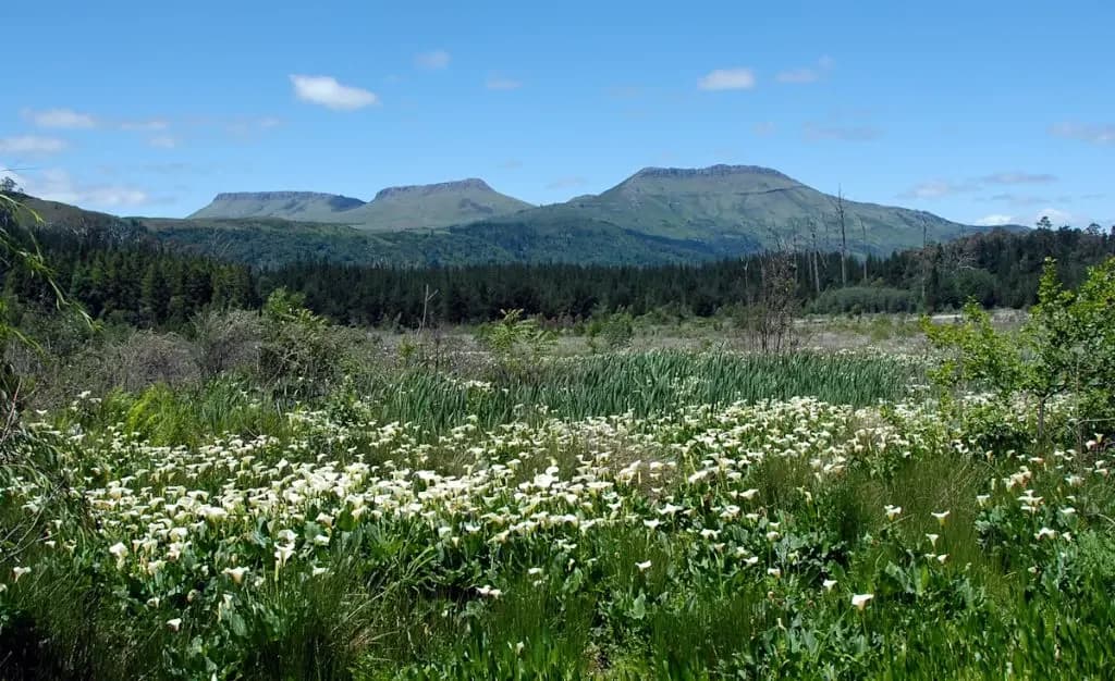
The Hogs rising beyond grassland and forest

The mountains around Hogsback

The Amathole
Mountains

Hogsback sits within a much larger landscape of forested ridges, open high ground, deep valleys and mountains that shape life below.

Into the Amatholes
Amathole Mountains · Eastern Cape

Part of something greater

Hogsback in
the Amatholes.

From below, Hogsback appears to sit high against a wall of forest and ridges. Reach the plateau and the landscape opens once more into escarpments, grassland, valleys and higher peaks.

The Amathole Mountains extend across the central Eastern Cape, roughly from the country around Stutterheim towards Adelaide. Hogsback, Gaika’s Kop, Elandsberg and Katberg are different parts of that broader mountain system.

Forest gathers in sheltered folds. Grassland covers exposed heights. Water leaves the plateau through ravines and waterfalls. The village makes more sense when it is seen as part of this geography rather than something separate from it.

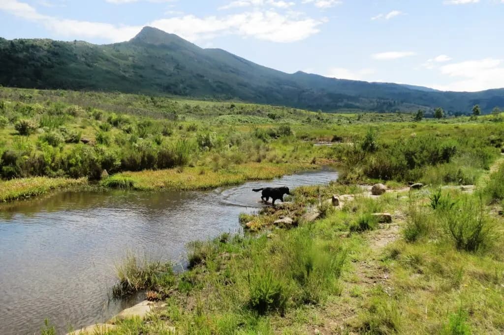
Mountain grassland and a stream beneath the surrounding ridges
Open high ground, water and forest meet around Hogsback.

The familiar silhouette

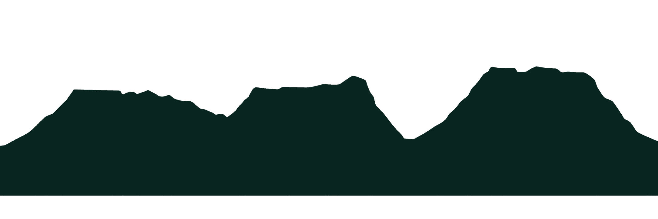
The Three Hogs.

The ridges most closely associated with Hogsback rise behind the village like a rough, bristled back.

Hogsback’s mountain backdrop

Reading the ridgeline

The three ridges known as the Hogs form the village’s most familiar silhouette. Open slopes and rocky edges rise above the forest, giving the skyline its distinctive profile.

They are the local landmark within a much broader range. Look beyond this backdrop and the landscape continues through neighbouring peaks, folds of forest and deep valleys.
Getting your bearings

The valleys below.
The peaks beyond.

Hogsback’s geography works in both directions: upwards to the surrounding mountains and down from the plateau into the country below.

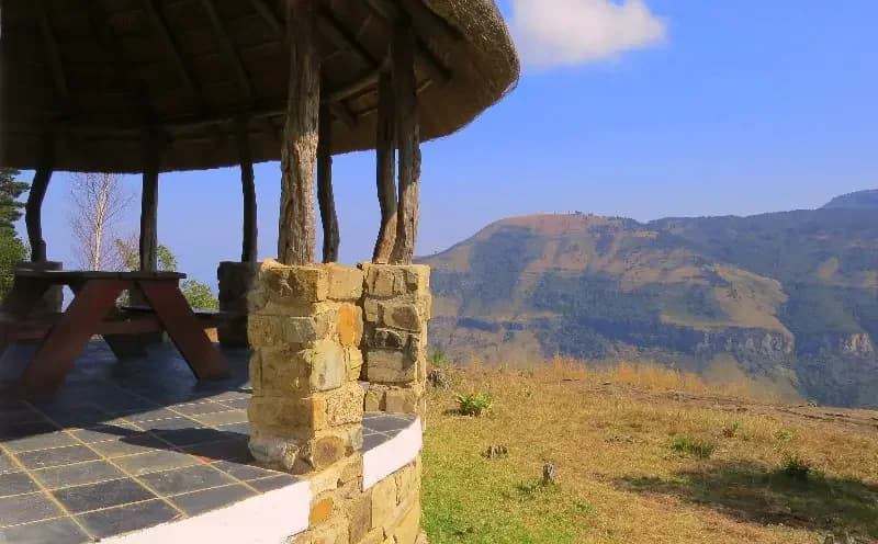
A view across the valley from a shelter at The Edge
A view from The Edge, across the valley beyond Hogsback’s plateau.

From plateau to valley

A landscape with depth

Below the village, the forested escarpment falls towards the Tyhume Valley. Ridges and ravines carry the eye into the lower countryside, while higher peaks rise around the plateau.

That change in elevation is part of what makes the views here so striking. Hogsback is surrounded by mountains, but it is also a place to look down from.

The prominent landmark

Gaika’s Kop

Approximately 1,960 metres

Its isolated shape makes Gaika’s Kop a distinctive landmark across Hogsback and the surrounding countryside. High grassland and exposed slopes give it a different character from the forests below.

This is proper mountain terrain. Check current access and permit arrangements before planning a hike.

Towards Cathcart

Elandsberg

Just over 2,000 metres

Elandsberg rises higher still, adding another substantial mountain to the surrounding skyline. A stone formation on its southern slope is often described as heart-shaped.

Much of the surrounding land is privately owned farmland. For most visitors, this is a mountain to appreciate from a distance.

Closer to the village

Tor Doone

Elevated views across Hogsback

Smaller and more immediate than the higher peaks, Tor Doone is closely connected to the village landscape. Its elevated ground opens views across Hogsback and the mountains around it.

Confirm current access to Tor Doone and the Contour Path with the AFC kiosk.

A landscape shaped by water

Where the
water begins.

Mist, cloud and rain feed streams across the plateau before the water drops into forested valleys.

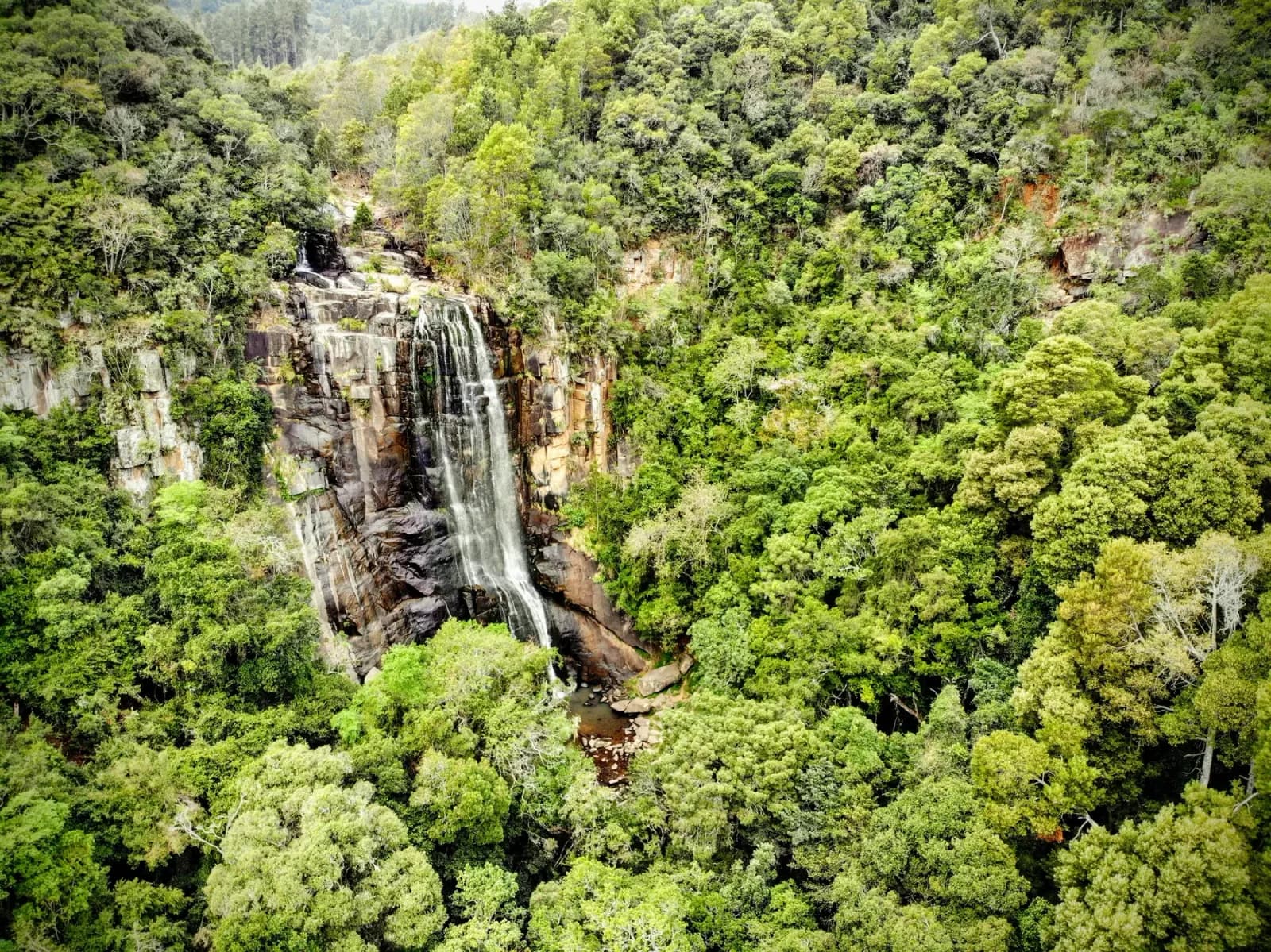
Water is not simply passing through Hogsback. Over time it has shaped the escarpment, ravines and cliffs. It also creates the waterfalls that make the village’s forest walks so distinctive.

Altitude helps explain why Hogsback can feel so different from the lower country. Rainfall and temperature shift with elevation. Cloud settles around the ridges, and a clear horizon can disappear in minutes.

Walking in this landscape

Two worlds, one mountainside

Forest below.
Grassland above.

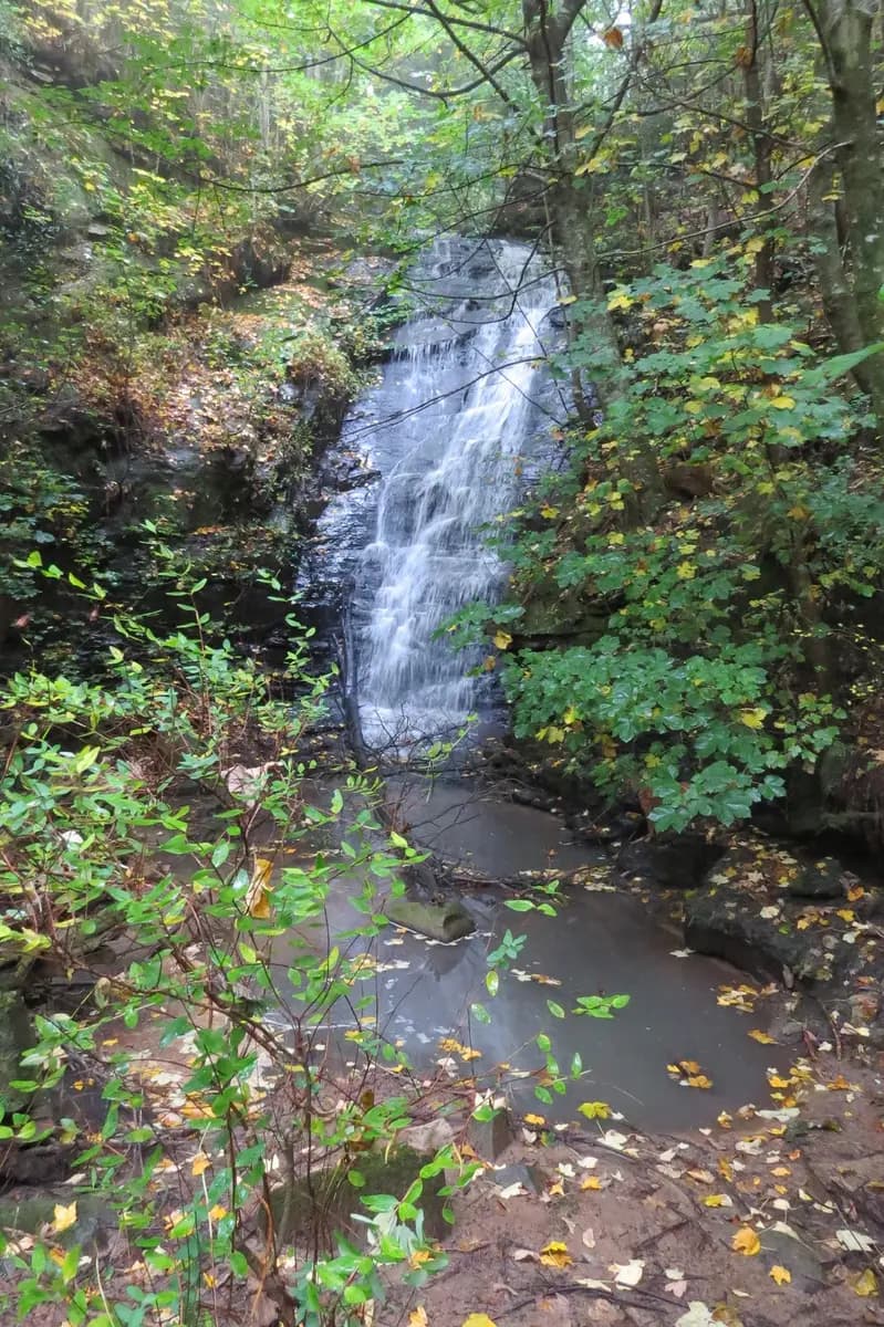
Dense indigenous forest surrounding a Hogsback waterfall
Open mountain grassland beneath the ridges

Elevation changes everything

From canopy to open sky

Sheltered, moist slopes hold indigenous Afromontane forest: yellowwoods, white stinkwoods, Cape chestnuts, ferns and moss. Higher ground becomes cooler, windier and more exposed, changing into montane grassland, rocky outcrops and open ridges.

Inside the forest the mountains can feel hidden and enclosed. Above it, valleys and distant countryside suddenly come into view.

These habitats remain connected. Mature indigenous forest provides vital habitat for the endangered Cape parrot, while the surrounding mountains shape the rainfall, water and climate the forest depends upon.

A mountain climate

Mountain weather

Clear light makes every ridge feel close. Then mist moves over the plateau and the whole horizon disappears.

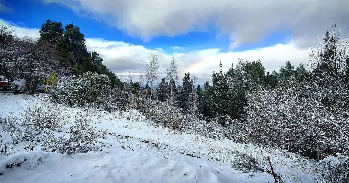
Snow covering Hogsback ground and trees
Winter cold occasionally brings snow to Hogsback and the higher surrounding country.
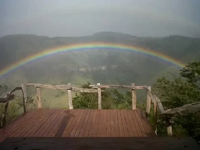
A rainbow appearing through mist over the valley
Rain, cloud and changing light are part of the mountain’s everyday character.

The greater Amathole landscape

The wider range

The short forest walks around Hogsback are an accessible edge of a much larger mountain system.

The wider range includes Gaika’s Kop, Elandsberg, Katberg, Devil’s Bellows Neck, Kubusi and extensive forests towards Stutterheim and Keiskammahoek. Rivers rise in these mountains and several peaks reach beyond 1,700 metres.

The multi-day Amatola Trail travels through this larger world of indigenous forest, valleys and exposed high terrain. Its demanding character puts the scale of the surrounding wilderness into perspective.

The everyday horizon

Explore the
mountain landscape.

Follow a forest path, spend time at a viewpoint or head into the higher country with a little more preparation.

Our hiking overview introduces the terrain, weather and access considerations. Explore brings together the individual walks, waterfalls and viewpoints.